This website is intended as an adjunct to the paperback book 'Camp Every County, Washington' by Brendan J. McDonald, available on Amazon.com. Included on this website are photographs and texts which could not be included in the paperback edition, where you will find full narrative versions of each section found below.
SKAMANIA COUNTY (Stevenson) |
Beacon Rock State Park (includes Skamania Co.'s BEST BIKE-IN CG, BEST GROUP CG, and only BOAT-IN CAMPSITES)
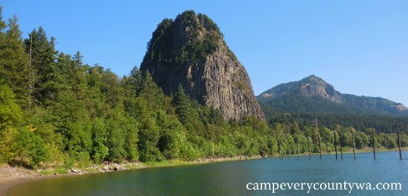 The "Rock" at Beacon Rock State Park is the 848-foot basalt core of an extinct volcano The "Rock" at Beacon Rock State Park is the 848-foot basalt core of an extinct volcano
For more photos of Beacon Rock S.P. click HERE
|
Timberlake Campground & RV Park (Skamania Co.'s BEST EQUIPPED/ BEST CG FOR RVs)
|
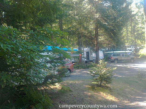 The wind surfing boards at Timberlake Campground create a carnival of colors. The wind surfing boards at Timberlake Campground create a carnival of colors.
For more photos of Timberlake CG and RV Park click HERE
|
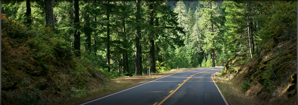
Panther Creek Campground (Skamania Co.'s MOST APPEALING CGs TO THE SENSES)
Panther Creek Campground seduces you into a camper's coma so that you'll never want to leave
For more photos of Panther Creek CG click HERE |
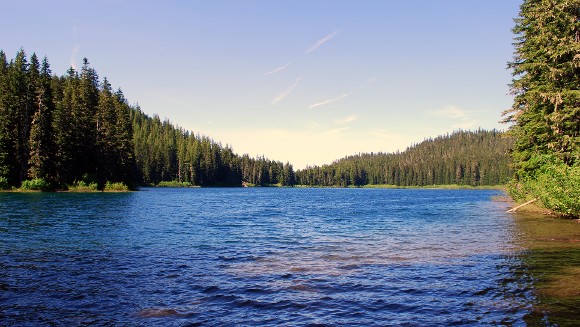
Forlorn Lakes Campground (Skamania Co.'s BEST RUSTIC CG)
 "Forlorn" is an odd designation for such a happy place as Forlorn Lakes "Forlorn" is an odd designation for such a happy place as Forlorn Lakes
For more photos of Forlorn Lakes CG click HERE
|
Takhlakh Lake Campground (Skamania Co.'s MOST UNIQUELY WASHINGTON CG) |
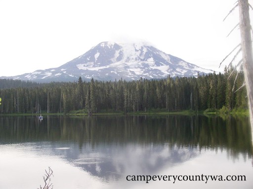
Takhlakh Lake captures the perfect reflection of Mount Adams
For more photos of Takhlakh Lake CG click HERE
|
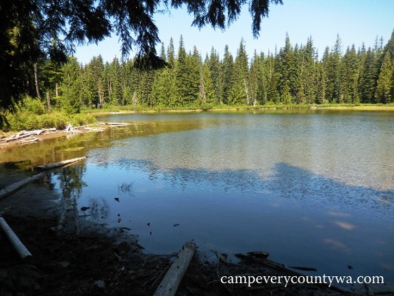
Council Lake Campground (Skamania Co.'s BEST FREE CG)
|
 Council Lake Campground sits on one of the more pristine lakes in the area Council Lake Campground sits on one of the more pristine lakes in the area
For more photos of Council Lake CG click HERE
|
Lower Falls Recreation Area (Skamania Co.'s BEST CG FOR ENTIRE FAMILIES)
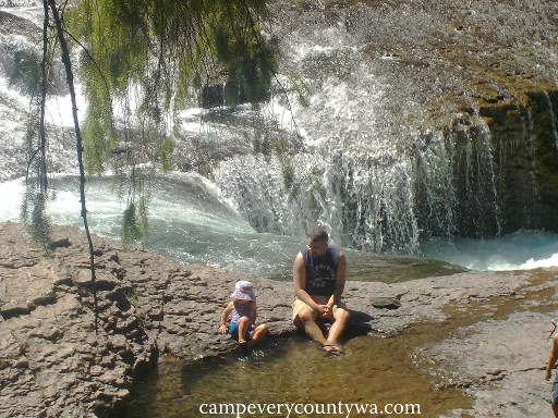
Lower Falls Campground sits on the edge of one of the most complex and mesmerizing waterfalls in Washington
For more photos of Lower Falls CG click HERE |
- Thomas Lake and Vicinity Hike-In Campsites (Skamania Co.'s BEST HIKE-IN CAMPSITES)
It is rare for camping to be allowed in wilderness areas, especially one so dramatic, breathtaking, and yet so accessible by hikers, campers, and all other adventurers. It was heaven for the native peoples, and now for all of us.
Overview: This series of campsites is located 29 miles north of Stevenson and just 0.37 miles in from the Lake Thomas Lake Trail #111 Trailhead. It is operated by the USFS at 4500' elevation. The campsites are best used from May until October; GPS for Trailhead 46.0057, -121.83923, see more below.
Facilities are limited and primitive. Water should be packed in, or treated before using.
Recreation: Wildflower viewing is quite engaging here. Huckleberry picking is quite popular in late summer. Most of the lakes are stocked for fishing. Hiking continues on past Thomas Lake to the great views of the Umtux Lakes, and beyond that to Blue Lake (see below).
Trailhead: To reach the Thomas Lake Trail #111 TH, start in Carson. Drive North on the Wind River Hwy (Forest Road 30) for about 5 miles to Forest Road 65. Turn right onto Old State Road and take the 1st left onto Forest Road 65/Panther Creek Road. Continue for 16 miles. Trailhead will be on the right.
GPS coordinates for campsites:
Site #1 121° 49' 51.3W 46° 0' 15.6N
Site #2 121° 49' 51.5W 46° 0' 06.8N
Site #3 121° 49' 48.0W 46° 0' 03.9N
Site #4 121° 49' 43.9W 46° 0' 06.1N
Site #5 121° 49' 42.7W 46° 0' 12.4N
Site #6 121° 49' 37.6W 46° 0' 19.2N
Site #7 121° 49' 29.8W 46° 0' 22.4N
Campsites (7 sites dispersed around 5 small lakes. FREE with a free self-issue Wilderness Permit available at TH): Sites 1-5 are around Thomas Lake. Site 3 is also close to little Kwaddis Lake. Sites 6 and 7 are between Heather and Eunice Lakes.
Best Local Alternative is Blue Lake and Vicinity Hike-In Campsites.
Overview: This set of campsites is located an additional 3.7 miles east on Thomas Lake Trail #111, best used May until October; GPS, see below.
Recreation: Blue Lake, Tombstone, and Sahalee-Tyee are the best fishing lakes in this group. Hiking continues on as the trail #111 connects to the Pacific Crest Trail, and the beginning of the awesome 16.5-mile Wilderness Lakes Loop hike. Hiking past Blue Lake is considered much more challenging.
Trailhead: Same as above for Thomas Lake.
GPS coordinates for campsites:
Site #8 121° 47' 55.7W 46° 59' 12.2N
Site #9 121° 47' 01.3W 46° 59' 08.3N
Site #10 121° 47' 47.3W 46° 59' 07.3N
Site #11 121° 47' 49.2W 46° 59' 00.3N
Site #12 121° 47' 48.2W 46° 58' 59.3N
Site #13 121° 47' 41.5W 46° 59' 01.9N
Site #14 121° 47' 42.2W 46° 59' 00.1N
Site #15 121° 47' 38.9W 46° 58' 55.6N
Site #16 121° 47' 35.5W 46° 58' 49.7N
Campsites (9 sites dispersed around 4 small lakes. FREE with a free self-issue Wilderness Permit available at TH): Site 8 is on Sahalee-Tyee Lake. Sites 9-14 are closest to Blue Lake. Sites 15 and 16 are closest to tiny Tombstone Lake.
Trip Notes: Though high in elevation, the trail is relatively flat and manageable by most.
|
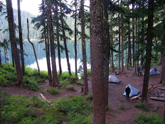 Thomas Lake Hike-In Campsites are unique in allowing camping in wilderness areas Thomas Lake Hike-In Campsites are unique in allowing camping in wilderness areas
For more photos of Thomas Lake Hike-ins click HERE
|
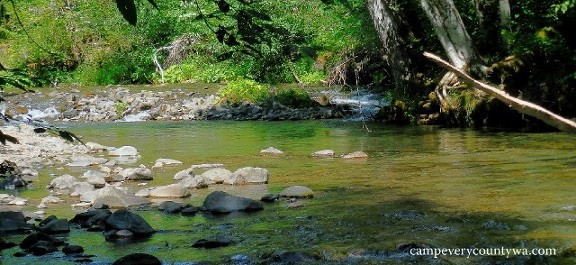
- Moss Creek Campground (one of Skamania Co.s MOST APPEALING CGs TO THE SENSES)
This cozy little campground sits on a gentle slope half surrounded by the Little White Salmon River and lush forest.
Overview: This lush and misty campground is located 20 miles northeast of Stevenson and 5 miles north of Willard on 7 acres, bordered by the Little While Salmon River, operated by the USFS at 1400’ elevation, open early May through mid-September; GPS 45.7948, -121.6329.
Facilities: These include vault toilets, water by spigot, fire rings, picnic tables, and camp hosts.
Recreation: The Little White Salmon River is thumbs up with whitewater kayakers, and includes many high quality rapids over a very long season, adequate for class V paddlers. Fishing is also good for brook and rainbow trout.
Campsites (17 back-in and pull-through sites for tents and RVs up to 30', no hookups, reservable): The sites are large and private, with dogwood trees adding to the usual mix of Douglas fir, hemlock, cedar, and big leaf maples. They are arranged in one small (2 sites) and one larger loop.
Trip Notes: This small campground reminded me of a hilly version of Panther Creek CG. Unlike Panther Creek, there was always someone in view either carrying a fishing pole or fishing in the Little White Salmon River. This will be a camper’s paradise for those seeking the forest experience, and is short drive from the Lewis and Clark Hwy 14. A word of warning: unless you wish to get lost like we did, be sure to take the Cook-Willard Road off of Hwy 105 (this will be Hwy 14) then take a right turn onto Willard Road 3-4 miles up the road. When you get to the town of Willard, you know you're on your way.
Camping Alternative: Oklahoma CG (USFS, 23 sites, no hookups; reservable) is further up the same paved road. Only a few campsites were open, due to extensive damage that appears to be an accumulation of several winters. The road at the end of the loop had a drop of about 18", and roped off without further explanation. We can recommend this campground only if Moss Creek is full.
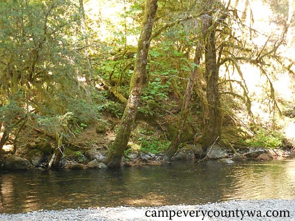
Lush and misty Moss Creek Campground sits on a gentle slope half surrounded by the Little White Salmon River
For more photos of Moss Creek CG click HERE
|
|